Zoning & Subdivisions
Zoning
The Land Use Bylaw divides the City of Camrose into the following districts:
- AIR, Airport District
- C1, Central/Downtown Commercial District
- C2, Highway Commercial District
- C3, Neighbourhood Commercial District
- DC, Direct Control Districts
- ER, Environmental Reserve District
- I, Institutional District
- M1, General Industrial District
- M2, Heavy Industrial District
- MH, Mobile Home and Transition Neighbourhood District
- PR, Parks and Recreation District
- R1, Low Density Residential District
- R2, Mixed Use Residential
- R3, Medium Density Residential District
- R4, High Density Residential District
- SCD, Special (Historical) Commercial District
- SEED, Special Event and Entertainment District
- SRD, Special (Historical) Residential District
- UR, Urban Reserve
To find out the description or regulations for a specific zone, please view our Land Use Bylaw.
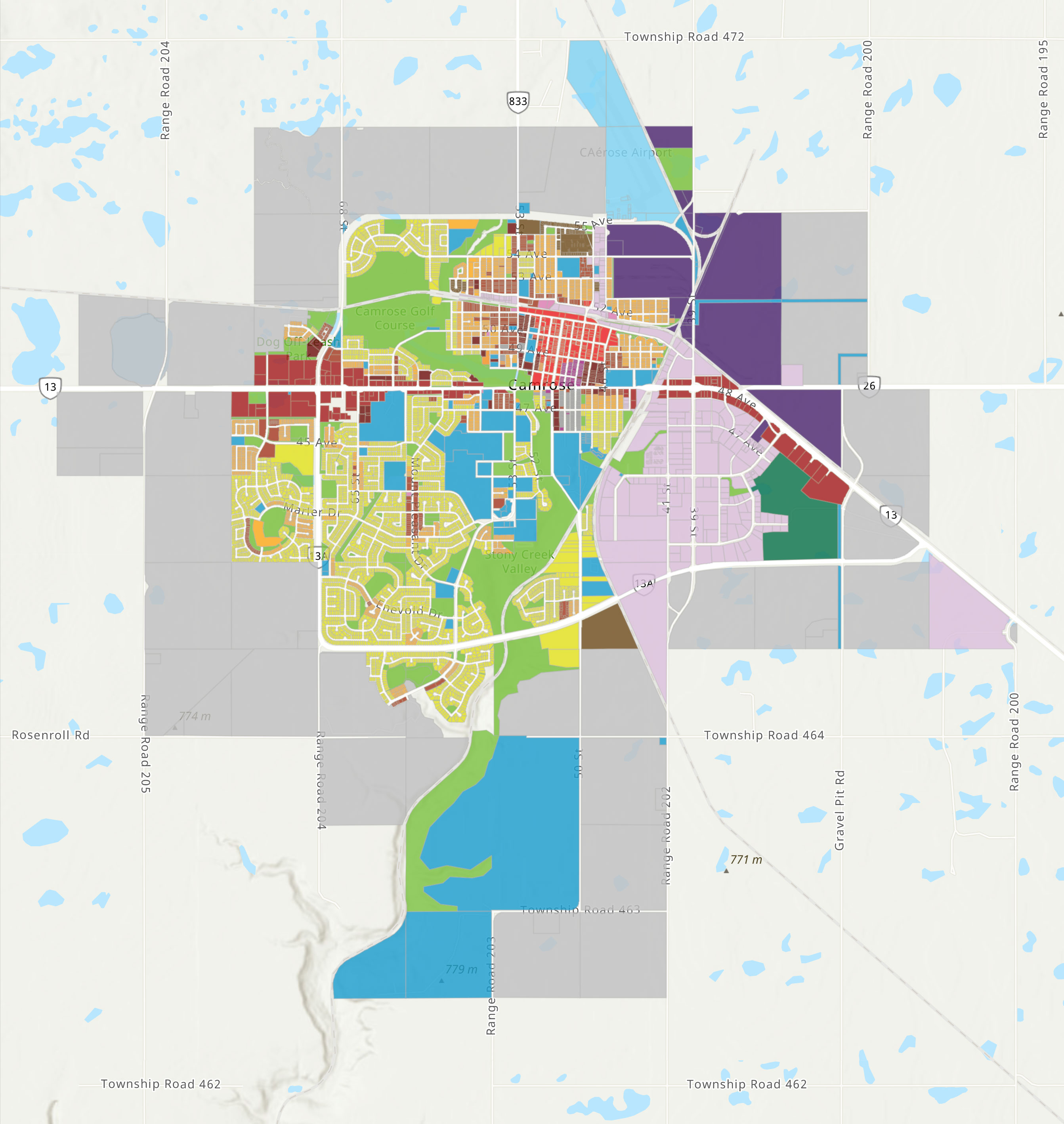
Land Use Map
See our printable Land Use Bylaw Map to view the zoning within the City of Camrose or click on the graphic below for an interactive map.
Contact
Planning & Development
City Hall
5204 - 50 Avenue
Camrose, AB T4V 0S8
P. 780.672.4428
F. 780.672.6316
E. planning@camrose.ca